Mapping Science
 Can geography and science mix? Of course, especially with Google Maps! Check out these lesson plans over at Quest: http://goo.gl/Djwg5
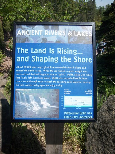
This summer's travels to Gatlinburg and the Boundary Waters both included several opportunities to show my kids the science behind geography. Now we may not agree with everyone's interpretation of the data (billions of years versus universal flood), actually walking on the rocks and trying to understand what we see is really quite fun.
Another way that Google Maps can help is by providing satellite imagery. That's something most schools did not have access to just a few years ago.
.jpg)


Comments
Post a Comment